
PADUCAH – The National Weather Service in Paducah says a Flood Watch is in effect for much of the area tonight through Saturday night.
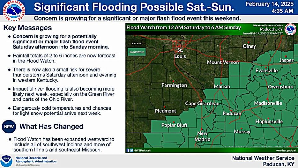
Excessive runoff may result in flooding of rivers, creeks, streams, and other low-lying and flood-prone locations.
Rainfall amounts of 2 to 3 inches are forecast, with localized higher amounts up to 5 inches possible. The ground is already saturated across the region, so this rain could lead to significant flooding impacts through the weekend. Rises on area rivers are expected as well.
You should monitor later forecasts and be prepared to take action should Flash Flood Warnings be issued.
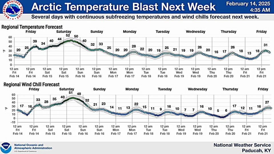
Forecasters say bitterly cold air is forecast for the majority of next week with wind chills dropping into the single digits or teens beginning on Sunday, and possibly below zero for some areas next week.
There remains a potential for accumulating snow Tuesday into Wednesday next week.